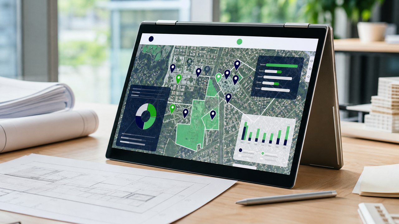
Every morning, operations managers must match a stream of incoming demand with available resources. Some jobs are scheduled in advance, others recur on a set cycle, and urgent incidents must be inserted into the schedule immediately. If addresses are inaccurate, travel times are estimated from experience alone, and team capabilities have not been fully matched to requirements, a plan that looks reasonable on the dispatch board can quickly break down in the field.
This challenge takes many forms. Distributors must reorganize sales territories; warranty networks must evaluate service-center locations; HVAC and telecommunications companies must dispatch technicians; maintenance providers must track asset-inspection schedules; and waste collection or infrastructure repair teams must respond to changes throughout the day. Each field has its own rules, but all must answer the same questions: Where is the job, which resource is qualified, how long will it take to reach, and which schedule is genuinely feasible?
Building on these shared needs, this article presents a Mapvina application framework that spans address standardization, travel-time calculation, routing, exception handling, and results reconciliation. Industry-specific examples show how data, constraints, and KPIs should be adapted rather than repackaging the same solution under different names.
Mapvina provides the location-data layer for the workflow: finding and standardizing addresses, converting addresses to coordinates, matching coordinates to addresses, calculating distance and time over the road network, finding routes, and supporting multi-stop route optimization. According to public information, Mapvina supports Search/Autocomplete, Geocoding, Reverse Geocoding, Routing, Distance Matrix, and VRP–Logistics; Routing supports motorcycles, cars, and trucks.[1]
Mapvina does not replace a DMS, CRM, FSM, ERP, asset management system, or industry-specific software. Those systems remain responsible for customer records, orders, equipment, workforce skills, inventory, SLAs, maintenance cycles, vehicle loads, and job outcomes. Mapvina's role is to turn the questions of “where, how far, how long, and in what sequence” into an integrable, measurable, and reusable service layer.
Despite different terminology, every workflow has five basic entities:
When these five groups are scattered across spreadsheets, chat groups, and dispatchers' memory, businesses tend to select whoever “seems close,” divide territories along administrative boundaries, build routes from experience, and discover that a schedule is infeasible only after the workday has already unraveled.
A shared framework does not mean every industry uses the same formula. It means businesses can share a data architecture and location services, then configure workflow-specific constraints.
Territory design
The goal is not merely to rename wards and communes in a database. A business must link old and new addresses to the same customer, preserve order history, determine which territory each outlet belongs to, and transfer ownership without creating duplicate customers or omissions. Mapvina publicly states that it can return addresses based on the new administrative data and optionally display the former address; this is an important input for reconciliation.[1]
The specific constraint here is data continuity. A new customer ID must not be created simply because a territory name has changed; every bulk update needs logs, versioning, and an exception queue for human review.
Service network
Here, the “resource” is a fixed center rather than a person in motion. The business geocodes historical warranty requests, calculates travel times from existing centers, and models candidate locations. A strong location must balance demand, service time, technical capacity, occupancy costs, and access to parts warehouses.
Mapvina can provide the time matrix and map layer used in the analysis. The investment decision still requires financial, legal, workforce, and demand data—none of which can be inferred from a map alone.
Market coverage
The business plots outlets, orders, employees, and distributors in a common spatial reference system. A “white space” is not simply an area with no dots on the map: it may be an area with unmet demand, outlets that receive infrequent service, or travel times that are too long for current teams.
Search/Geocoding helps clean outlet data; Distance Matrix evaluates accessibility over the road network rather than by radius. The DMS and business data must still confirm whether the area has sales potential.
Technical service
A repair ticket requires the right skills, parts, customer availability window, and SLA. The nearest technician may not be suitable if they are busy, lack the required expertise, or do not have the necessary parts. Distance Matrix and Routing help assess travel; the FSM and inventory system must confirm capability and materials.
Specialized KPIs include first-time fix rate, repeat visits caused by missing parts, and arrival-within-window rate.
Telecommunications
This workflow resembles HVAC service but adds infrastructure constraints: network ports, cable routes, building type, building-access rights, and sometimes coordination across multiple roles. The schedule should group appointments geographically without assigning a request to a location where infrastructure is not ready.
Key KPIs include first-time installation success rate, time from registration to activation, rescheduled appointments, and jobs completed per workday.
Preventive maintenance
The job location is the building; demand is generated by maintenance cycles and regulations, not only by incidents. The schedule must combine recurring work with the emergency queue, equipment-model expertise, building-management working hours, and safety requirements.
Distance optimization matters only after every asset due for service has been scheduled within its permitted window. Core KPIs are on-time maintenance rate, number of overdue assets, travel time, and post-maintenance incident rate.
Specialized transportation
Here, the resources are vehicles and collection crews; core constraints include vehicle capacity, waste type, permitted operating hours, collection-point frequency, and transfer-station locations. A short route that fills the vehicle before it reaches the disposal station is not feasible.
Vehicle-specific Routing, Distance Matrix, and VRP–Logistics can support the journey-planning component.[1] The specialized system must still supply projected loads, collection-point status, vehicle shifts, and safety rules.
Urban infrastructure
This problem involves both incident locations and an asset network. Priority depends on the pipeline, affected area, safety risk, and number of customers whose service is interrupted—not distance alone. The nearest team may lack excavation equipment, replacement-pipe materials, or authorization to work on that line.
Mapvina supports incident location and access routing. The network management system must identify valves, pipe routes, history, and impact scope. KPIs include time to acknowledge, time to isolate, time to restore, recurrence rate, and number of affected customers.
Distributed assets
These three asset types differ, but all require a reliable location registry, inspection schedules, condition records, and maintenance routes. Their criteria differ: billboards involve structural condition and permit expiration; BTS stations involve equipment, power, and site-access rights; ATMs involve cash, security, and access windows.
Reverse Geocoding can help reconcile field GPS points with reference addresses. However, automatically generated coordinates should not overwrite an asset record without verification and a change log.
| Component | Can be shared | Must be configured for each field |
|---|---|---|
| Location registry | Location ID, raw address, standardized address, coordinates, verification status | Customer, equipment, asset, collection-point, or incident type |
| Job demand | Job ID, location, duration, priority, time window, status | Maintenance cycle, SLA, waste type, incident severity, sales target |
| Resources | Resource ID, shift, start/end point, vehicle, capacity | Technical skills, vehicle capacity, certifications, authorized area, parts inventory |
| Location services | Search, Geocoding, Reverse Geocoding, Distance Matrix, Routing, VRP–Logistics | Vehicle profile, access point, journey constraints, and objective function |
| Execution | ETA, arrival/departure, check-in, outcome, exception reason | Orders, parts, waste volume, isolation time, asset report |
| KPI | Schedule adherence, time/distance, productivity, data accuracy rate | Coverage sales, first-time fix, cycle compliance, service restoration, load utilization |
This is a critical boundary:Mapvina can be reused as a platform layer, but business rules cannot be copied unchanged from one industry to another.
Businesses should design the data model around a shared core with extensions. The shared core includes:
location_id: immutable identifier for a service location or asset.raw_address: address supplied by the customer or a legacy system.normalized_address: standardized address.latitude, longitude: coordinates and the source used to generate them.verification_status: unverified, customer-confirmed, employee-verified, or needs review.job_id, job_type, priority: job identifier, job type, and priority.service_window, expected_duration: time window and expected duration.resource_id, shift, start_location, end_location: resource and shift data.capability_tags: skills, vehicles, certifications, or functions.actual_arrival, actual_departure, outcome, exception_reason: execution data.Extensions contain specialized information such as parts inventory, vehicle load, elevator model, cable infrastructure, pipeline class, outlet sales, or asset permits.
Records must retain both the raw and standardized address. Geometrically accurate coordinates are not necessarily a suitable access point: a building may have multiple entrances, an industrial park may require registration, and an alley may restrict vehicle access. Records should include an access_point, access instructions, and travel time from the entrance to the work location.
Input data
A DMS, CRM, FSM, or specialized system creates the request. Search/Autocomplete helps users select a consistent address; Geocoding converts the address to coordinates.[1] If a point has low confidence, the request enters a verification queue rather than proceeding automatically through the entire workflow.
Data governance
The system detects duplicate coordinates, different addresses that refer to the same point, locations outside the territory, and incomplete records. After an administrative change, the business links old and new addresses to the same location_id, preserving the customer's history.
Demand
Demand may originate from an order, appointment, maintenance cycle, incident alert, collection-point fill level, or sales campaign. Before sending it to the planning layer, the business system defines priority, SLA, duration, and mandatory conditions.
Resources
Before calculating “who is nearest,” the system excludes resources that lack the required skills, vehicle type, capacity, certification, materials, authorization, or working hours. This is a business-control gate; the map cannot infer these conditions.
Accessibility
Distance Matrix compares time and distance among multiple resources, job locations, centers, or territory clusters. Routing creates directions for the appropriate vehicle. This analysis replaces assumptions such as “locations in the same district are close” or “a point within a three-kilometer radius can be served.”[1]
Scheduling
VRP–Logistics can take a list of locations, time windows, durations, shifts, start/end points, and standardized constraints to propose sequencing or allocation.[1] The result must also identify jobs that cannot be scheduled. A credible plan must not compress durations or ignore constraints merely to display a complete route on screen.
Controls
A dispatcher or manager reviews strategic customers, temporary road closures, restricted building hours, safety risks, new resources, unusual incidents, or information that has not been digitized. Every edit should include a reason code so the system can identify missing rules.
Execution
The field application receives the destination, sequence, ETA, and job record. When a job runs long, a vehicle fills early, a customer cancels, or an emergency arises, the system recalculates the remaining schedule and shows the effect on SLAs, distance, and other commitments.
Improvement
End-of-day results return to the business system. Managers distinguish deviations caused by addresses, travel estimates, standard durations, capability gaps, customers, vehicles, or execution behavior. This data is used to refine rules, not merely to evaluate employees.
Field service management typically connects the office, dispatchers, mobile workers, and customers; common functions include scheduling, dispatch, work tracking, and inventory management. Implementation guidance also emphasizes clean data, a small pilot, and KPIs such as first-time fix rate and travel time.[2]
In the shared architecture, the business system is the system of record. Mapvina receives approved location fields and journey constraints, then returns spatial results.
| Integration point | Data sent to Mapvina | Returned result | Responsible system/role |
|---|---|---|---|
| Address entry | Address string, search area | Suggestions, standardized address, coordinates | CRM/DMS/FSM and data steward |
| Network analysis | List of locations, centers, and resources | Distance/time matrix | Planning or operations team |
| Planning | Job locations, shifts, vehicles, and business constraints | Route, sequence, ETA, infeasible jobs | Dispatcher/manager approval |
| Execution | Destination and approved plan | Directions and map data | Field application |
| Reconciliation | Plan, check-ins, and actual locations | Plan-versus-actual spatial analysis | Operations management |
An API failure must not bring field operations to a complete stop. Businesses need to retain issued schedules and provide a retry queue, error monitoring, a manual dispatch mode, and a notification process for ETA changes.
A single savings percentage should not be announced in advance for every application. The pilot must measure a baseline for each workflow. Shared KPIs include:
| Industry/use case | Industry-specific KPIs to track |
|---|---|
| Sales territory management | Records assigned to the wrong territory, duplicate customers, percentage of outlets with an assigned owner, territory-transfer processing time |
| Warranty service-center selection | Percentage of demand within the service-time threshold, load by center, response time, network cost |
| Underserved sales-area detection | Outlet coverage, service frequency, sales in new territories, percentage of potential outlets verified |
| HVAC service | First-time fix, repeat visits due to missing parts, ETA complaints |
| Internet installation | First-time installation success, activation time, appointments rescheduled because infrastructure was not ready |
| Elevator maintenance | Assets maintained on time, overdue assets, incidents after maintenance |
| Waste collection | Missed points, vehicle fill level on return to the station, number of transfer trips, volume per shift |
| Water-service repair | Time to acknowledge, isolate, and restore; affected customers; recurrence rate |
| Distributed asset management | Assets with incorrect coordinates, overdue inspections, anomaly-resolution time, condition-record quality |
Quantitative targets must be set only after establishing a baseline; they must not be presented as outcomes that Mapvina produces automatically. Mapvina most directly affects location quality, accessibility, time/distance, and schedule feasibility. Sales, first-time fix rate, and restoration time also depend on business processes, people, materials, and infrastructure.
A shared platform offers reusable integrations, but implementation is not free. Businesses should budget for:
The cost of an HVAC pilot should not be applied to water services or waste collection. Different numbers of locations, reoptimization frequencies, levels of integration, and safety requirements will change the cost structure.
Correct coordinates but the wrong access point: Add the access entrance, vehicle type, and field verification.
Stale business data: Outdated skills, vehicle capacity, inventory, or asset status will produce an incorrect plan even when the map is accurate. Every field needs an owner and an update cycle.
Optimizing for the wrong objective: Reducing distance alone may breach SLAs, neglect potential areas, or delay maintenance. Industry-specific objective functions and constraints are required.
Overly optimistic schedules: Average durations conceal complex cases. Calibrate by job type, context, and actual-time percentile.
Automation beyond its authority: Do not automatically change territories, overwrite asset coordinates, or assign high-safety-risk work without approval rules.
Excessive tracking: Collect location data for operational purposes, only for as long as necessary, with appropriate access controls and retention policies.
Service dependency: Design for caching, retries, monitoring, retained issued schedules, and manual fallback.
Days 1–30
Do not roll out to every department at once. Select one dynamic workflow, such as technician dispatch, and one recurring or network-analysis workflow, such as asset maintenance. Standardize the location–job–resource, measure the baseline, and verify a sample of addresses.
Days 31–60
Integrate Search/Geocoding, Distance Matrix, and Routing first; use VRP only after constraints have been described clearly enough. Generate proposed plans in parallel with the existing process. Record every dispatcher edit and its reason. Test jobs that run long, incorrect locations, absent resources, lost connectivity, and urgent work.
Days 61–90
Issue schedules to the pilot group and track shared and industry-specific KPIs. After the pilot, separate three areas: reusable platform components, configurations that must change, and business functions that require another system. Expand to the next industry or department only when data, exception processes, and operational responsibilities are clear.
Not when a business puts every type of location on a single map. A shared platform creates value only when addresses and coordinates are reliable, requests are standardized, resources are filtered for eligibility, the schedule is willing to report “infeasible,” operators have authority to handle exceptions, and field outcomes feed back into better planning.
Sales and warranty management, HVAC and telecommunications service, elevator maintenance, waste collection, water-network repair, and distributed asset management differ operationally. They can nevertheless share Mapvina as a location and journey service layer while each field retains its own rules, data, and professional responsibilities.
This approach avoids repackaging the same solution under different industry names without reducing the article to generic claims. The platform layer is shared; decision logic must remain specific to each field.
Mapvina can work with operations and IT teams to review location-data quality, journey constraints, integration architecture, and the pilot KPI set before expansion.
This article presents an implementation framework; it does not describe results from a specific customer. The KPIs and roadmap are pilot-design recommendations, not performance commitments. Statements about Mapvina's capabilities and field service management practices are limited to the sources below. Businesses must confirm features, technical and commercial limits, SLAs, security, legal requirements, and integration feasibility at the time of implementation.
Moving this industry forward requires not only skill, talent and expertise, but also imagination. All are welcome.